Wednesday, July 06, 2011

A Stream in the Sky

When we drive into Wales towards Porthmadog we nearly always go through Llangollen and onto Corwen and Bala - past -'The Butterfly Man' - and  - 'Glassblobbery' - I always look out for both of them as familiar landmarks.  Sometimes we stop at Llangollen, sometimes Corwen or the lake at Bala.  This time we stopped at the canal basin in the village of Trevor just outside Llangollen to stretch our legs, have a picnic and walk across the 'Stream in the Sky'.

You wouldn't know from these photos, as I had to snap them very quickly because of the rain, that the place was very, very busy.  I hadn't expected it to be so popular especially on a wet Tuesday lunch time during term time but there were bus loads of  tourists and many cars with foreign number plates all visiting this wonderful World Heritage Site.

The canal walk was popular but it was obvious that most people, including us, had come to see the 'Stream in the Sky' - otherwise known as the Pontcysyllte Aqueduct.

At 126ft in height and over 1000 feet in length it is one of the longest and highest cast iron aqueducts in the world and has a Grade 1 listed building status.


As you can see I did walk halfway across but I had to turn and go back as I was a bit anxious about slipping in the heavy rain and there was a group of tourists coming towards us all with umbrellas and I couldn't see where we were going to pass.   The height was also getting to me!

The Pontcysyllte Aqueduct, built by Thomas Telford and William Jessop, opened in 1805 having taken about ten years in the making at a cost of £47,000.  It is 11ft wide and just over 5ft deep - you can see why I didn't want to slip - just looking at it again knots my stomach!

The Aqueduct, which carries the Llangollen Canal on its route towards Whitchurch and beyond where it joins the Shropshire Union canal at Hurleston Junction, spans the River Dee in the valley below.

After our walk and picnic we drove around to the other view point where I was lucky to get a photo of a boat crossing the aqueduct and was able to take in how high it is - had I really been up there?

On the route between the two viewing sites we found this lovely pack horse bridge - more my size I think - from where I took the photo above.  In the opposite direction was the most lovely building on the side of the river.  I thought how French it looked jutting out over the water!

I've taken the title of this post from the sculpture in the first photograph  - just because I liked the idea of a stream in the sky!  I'm guessing that the person who made the sculpture found the quote from a specific source in archives somewhere  but I haven't been able to find any reference to it as yet.

Monday, July 04, 2011

The Answer

The answer to feeling under the weather and in slightly low spirits is, for me, to go and find the sea which, thanks to our kind neighbours who let us stay in their holiday home every year and look after our cats as well, we were able to do.

We walked on quite a few beaches along and around the Llyn Peninsula and there are a lot more posts coming about all the things we have seen and done but for now we'll just have a wander up the cliff path at Borth y gest and look out over White Rock Sands - Black Rock sands are further around the headland.

Then we went down to walk along the beach at Borth y Gest,  where we found rock pools

Footprints in the sand

Lots of seaweed

and loads of jelly fish washed up by the tide and trapped on the beach

I could gaze out over this view across the Glaslyn Estuary towards Harlech for ages;  it is soothing, calm and pushes all those little niggles and anxieties to the back of your mind.

As we walked along the cliff path  we passed the house below - it's for sale.  Oh, if only! Just to have that view above every day!

I'm still not too old to have dreams and aspirations.

Thursday, June 30, 2011

Photo Scavenger Hunt - June 2011

Here are my photos for the June Scavenger Hunt.   Thanks as always to Kathy at Postcards from the PP for hosting the Scavenger Hunt and keeping us on our toes with her wonderful choice of topics.  Here is, I hope,  a -link- to other participating blogs.

A Childhood Memory
Buying a bucket, spade and fishing net when we got to the seaside and carrying them down to the beach where sand castles would be built with the bucket and spade and rock pools dipped with the net. 

A Farm Animal
One of the Highland Cattle at Wimpole Estate Home Farm, Cambridgeshire

A wheel trim
On a Bristol Fighter at the Imperial War Museum, Duxford, Cambridgeshire

An Elephant
Carved wooden elephant in a shop window
Architectural Detail
Chimneys on the Precentor's House across the green from Ely Cathedral, Cambridgeshire

Cheese
from the cheese counter in the Red Lion Quarter, Spalding, Lincolnshire


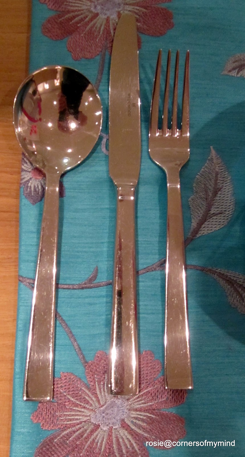
Cutlery
On a table display in the Wedgwood Factory shop, Barlaston, Stoke-on-Trent

Night
On the outside looking in!

Something beginning with Z
Zinfandel wine - goes well with the cheese!

The view right outside your door
Back door that is - outside my front door which is actually on the side of the house is next door's brick wall which doesn't make for a very interesting photograph.

Something with your town's name on it

Of the six towns that make up the city of Stoke-on-Trent, Longton is the closest to where we live.  This is the sign for the Longton Interchange (bus station) near the Tesco, Argos and Next stores.  Behind you can see the railway station where trains run between Derby and Crewe stopping at all stations in Stoke along the way and behind the station an old, derelict pottery factory with its bottle oven and chimney.

Tree Branches

Monday, June 20, 2011

Sometimes

Sometimes, when life gets too much............


........you just have to go and cuddle a cushion!
'bye for now:)

Saturday, June 18, 2011

Highlights from last two days

On Thursday we drove over to Spalding in Lincolnshire to visit some friends.  We had a lovely lunch in a pub by the riverside and then a wander around the town.  Spalding has altered so much since we left in 1995.  It was nice to go back and look at where I used to work.


This is Ayscoughfee Hall Museum, a 15th century red brick house at the side of the River Welland.  I used to work in the room whose window is just to the right of the black door in the photo below.  This was just behind the main hall and reception area which was then a Tourist Information Centre as well.


I was too busy enjoying myself to take many photos but we did visit a new place called the - Red Lion Quarter - where there was a restaurant and a shop full of mostly local produce.  We also popped into -  Sergi's Deli - down the Hole in the Wall -  Mr Sergison, who took part in the recent TV series called 'Turn Back time - The High Street' was behind the counter and had a chat with us.  We then visited  'The Bookmark'  a wonderful local, independent bookshop that has regular visits and talks by well known authors and then we had afternoon tea in the outdoor courtyard at Pennington's florist and gift shop.


After saying farewell to our friends we set off across the Cambrdgeshire fens to Ely.   Once we'd settled into our accommodation we took a late evening stroll along the riverside - photo above - and around the Cathedral.

View from parkland at the back of the Cathedral


The next morning we moved on to the Imperial War Museum at Duxford.  A whole morning was spent here gazing at the aircraft. 

The Flying Fortress

Concorde 101

RE8 - a world war one spotter plane

In the afternoon we visited the Wimpole Estate.  The Hall doesn't open on Fridays  but we had a wander around the gardens and the home farm.

The Hall from the Dutch garden

The Walled Garden

Two lovely, noisy residents of the home farm - Clementine and Daisy.

I'll be back with more on Wimpole Hall later this month as we are off on our travels again so I'm taking a break for a while.

Sunday, June 12, 2011

Ancient Waymarkers

In the corner of an area of land belonging to the Longshaw Estate is a wooden pole.   It stands near the triangular junction where the road from Sheffield to Hathersage joins the road down to Froggatt and Calver.

It is just a wooden pole in the ground but it is so well known that the area around it is known as 'Wooden Pole'.
What is it? 

According to some sources it is an old way marker for a pack horse route which leads down to Hathersage and marks the boundary between Hathersage and Holmesfield.   It isn't one of the original way markers or 'guide stoops'  but it has been there for many, many years and is occasionally replaced by the National Trust who own the site.  According to others and referring to the stone in the ground which is engraved 'T1778'  it is a boundary marker for the parish of nearby Totley at that date .

It is quite tall too!  I'm sure many people pass by without noticing it or think that it is the remains of a dead tree.  There is a little pull off on the road for a few cars and a gate through onto the field so you can get close to it.

In the grounds of the Longshaw Estate is another way marker or guide stoop (stoop being a Scandinavian word for stone).  This is a stone one engraved on each side of the stone.  The side above says 'Tidswell Rode'  - Tideswell Road

The engraving on this side says 'Hope Rode 1787'  - Hope Road

and this side says 'Sheiffeild Rode' - Sheffield Road.

There are a few more of these way markers around the estate and many more are to be found in the Peak District area of Derbyshire.

These were guides to follow along the ancient pack-horse trails which criss-cross the moors, hills and valleys of the Peak District. These trails are part of the industrial heritage of the area used by pack horse trains to carry such local  commodities as silk, cotton, lead and salt to the growing industrial towns of Manchester and Sheffield.  Travelling across the moors could take several days and  in certain weather conditions, be quite treacherous.  Travellers could easily lose their way.  In 1697 an  Act was passed that local surveyors should erect guide posts in the more remote areas showing the way to the nearest market towns.  There was no defined standard to presentation or appearance so many different types of guide stoops are to be found across the Peak District.

By the mid 18th century turnpike roads began to appear across the region with their own mile stones and signposts and the need for the guide stoops faded.  The stoops themselves usually date from 1709 onwards when another Act made it compulsary for parishes to provide guide posts at road junctions.  They were used to supplement or replace other types of  guides like cairns, crosses, way markers and wooden poles.  Which is where this post started - with a wooden pole!